

Introduction - From Marsaxlokk/Delimara Point to Cirkewwa.
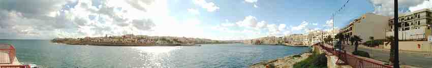
My wife, Anne, and I had decided to have a 3 week break in Malta during the Spring of 2004. As this would be our fourth visit, we felt it would make it more enjoyable if we had some objective rather than just doing a few walks between sunning ourselves, eating and drinking. And as Malta is only very small – 17 miles long by 8 miles wide - we decided to walk the length of the island. We felt this would give us a better perspective of the island, its people etc. as the route we planned would, in parts, take us away from many of the normal tourist areas.
I estimated that the total route would be 36 miles long and could be accomplished, subject to bus service and water crossings, in a couple of days. But we were on holiday. We had plenty of time and so the route was split into 6 easy walks; an average of 6 miles for each walk with the longest being no more than about 7 ½ miles. This would give us plenty of time to enjoy the sights and “smell the roses”, as one of my friends has often told me I should do. However, with Anne, rather than smelling the roses, it would be looking at the many wild flowers and shrubs that cover the island in Spring.
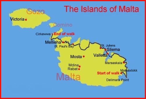
Map of Malta and our route
Although I have provided maps to indicate the routes used, anyone tackling any of these walks would be wise to obtain a map of Malta. Of the maps, one of the best is the Insight FlexiMap of Malta with a scale of 1:50,000, which indicates most of the island’s walking trails.
From my map, at the top of this page, it will be noted that Valletta was reached by crossing the Grand Harbour. As this may be considered a "bit of a cheat", when we visited Malta again in November 2005 we walked to Valletta from Vittoriosa (where we had caught the boat to cross the Grand Harbour). Here are the details, plus a link to a less traffic congested route from Marsa to Valletta supplied by a local guide.
Barry Riley